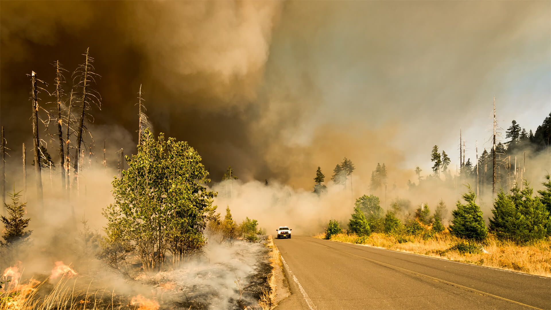
We’re talking about every hiker’s worst nightmare. No, not the feeling of slipping into wet boots that didn’t dry out overnight. We’re talking about smoke!
There’s a growing wildfire smoke problem across North America and there are three main drivers. The Western Rockies had an unusually dry year, causing large fires that could smolder well into the winter. Canada’s muskeg region is vast and swampy, but long-lasting and hard-to-control fires break out as the region dries out, sending waves of smoke across the US. And of course, Pineapple Express (no, not that kind of smoke); the atmospheric rivers that leave the PNW parched and fire prone. Surprisingly, the West Coast has fared much better than most years thanks to heavier rains.
The smoke situation is a recurring and hard-to-predict, but using FIRE.AIRNOW.GOV can help you track air quality and plan ahead.
Transcript
Hello, Peter Zeihan here coming from Colorado. And today we’re going to talk about smoke. This is a topic that is very near and dear to my heart as a backpacker. As you may have noticed, whether you’re living in Minneapolis or Chicago or Des Moines or Kansas City, we’ve had some crazy smoke outbreaks already this year. So I thought it’d be worth showing a tool to you, as well as talking through the three biggest things that shape the smoke forecast for the United States.
First of all, the tool fire.airnow.gov tracks a several thousand air quality sensors scattered across the country and maps out the smoke plume. So you know what to anticipate. Also gives you an idea of the danger level based on the particulate matter in the air, so you can judge your day accordingly. A tool that I use every day, all summer long. Use it to plan my trips, because I don’t want to be in the middle of that smoke choke, when I’m backpacking. Anyway, that’s the tool. Let’s talk about the three big things. Number one, moisture conditions in the Rockies, specifically the Western Rockies. As you move up elevation, the land becomes more arid because the air density is lower, so it can hold less moisture.
What that tends to mean is that as you move up, you get into a more and more arid environment where conditions can change very, very quickly from maybe adequate moisture to completely inadequate. And you introduce a spark weather through, some asshole with a cigarette or a lightning strike, and you can get a big forest fire very, very quickly.
Now, this year, the Western Rockies did not get as much moisture as they normally do. So they started out the season pretty dry. And already in western Colorado, we have a series of fires that collectively are about 200,000 acres and going. And most of the air quality issues we’ve had in the Denver area so far this year are because of those fires.
About the only good point I can say about these fires is because of the nature of the topography. Mountainous. Sometimes it’s difficult for the fires to jump from one valley to another, and they tend kind of, sort of to be somewhat self-contained. However, these are rugged areas. There’s low population density. It’s very difficult to fight fires in these areas.
And so if a fire does start up, they tend to burn until winter. And sometimes they’re not completely out until after Christmas. So these are kind of a chronic issue that kind of needles air quality throughout the Rockies. That’s number one. Number two Canada. Okay. So Canada is a very weird place, topographically speaking, is a huge country with lots and lots of climate zones.
But the one to watch the most is an area called the muskeg, which is a zone in northern Saskatchewan, in Manitoba, going over into the Canadian Shield, into western Ontario. These are areas that are almost completely unpopulated. And in the wet months they’re basically swamps. But if you have several months of low rainfall, the swamps start to dry out.
And as soon as that happens, all it takes is a spark and you can basically get some sort of surface peat fire almost that can burn, burn, burn and burn. At the time that I’m recording this in the middle of what is this August, there are over 200 fires burning in this section of Canada. In many ways, it’s more dangerous and more problematic than what we have in the Rockies, because these zones are not mountainous.
And so if you have an area that has become parched, it can just burn and burn and burning, burning, burn. And if you remember back in July when we had really poor air quality as far south as Kansas City and as far east as New York, almost all of that was because of these Canadian fires and because it’s swamp part of the year, and because it’s basically frozen tundra part of the year.
These are not things where any sort of mitigation can really help. In the Rockies, you can go through foot by foot, acre by acre, clear out the Deadwood cut down the dead trees, haul it all off, put it into piles or whatever. That’s something I’ve done on my property for sure, because I live in a fire zone. You can’t do that.
And the great untouched barrens of northern Canada, you just have to suffer through the fires and it’s going to be a bad fire. You’re up there. So for those of you in the Upper Midwest and the northeast part of the United States, expect more and more waves of smoke. All right. What’s the third one? Pineapple express? There are things called atmospheric rivers where you basically get channels of high altitude winds that suck moisture out of the oceans, and they just push them across the planet.
And when these channels hit a mountain range, they rise and they drop a lot of moisture. So what we see in California, Oregon, Washington and British Columbia is the atmospheric river whips around like a fire hose at the firemen has lost control of, and it will spray the area with massive amounts of rain in some years or in other years, it’ll miss you completely and you’ll just kind of get the suction effect.
And as the wind goes down the other side of the mountains, you get a compression effect, which actually increases air density and temperatures and makes you more prone to fires. So you get these two extremes. You get sprayed down by the atmospheric river hose, or it avoids you completely and just sucks the moisture along in its wake. Drying you out this year is absolutely a hose year, and so we’ve seen almost no fires up and down the Pacific Northwest.
But if you remember back to say, the year 2000, when it seemed the world was going to end, that time we actually saw the Amos River avoid this region completely desiccated. And we had some of the worst forest fires in recorded history. So for me personally, going to Yosemite and a couple of days, this is perfect because while there are fires in Canada, I’m not going that direction.
There are fires in western Colorado. I’m leaving that area. I’m going to California, which has now experienced some of its best moisture conditions in several years. The chances of fire are minimal for the rest of you, fire air now.gov and keep ahead of it.