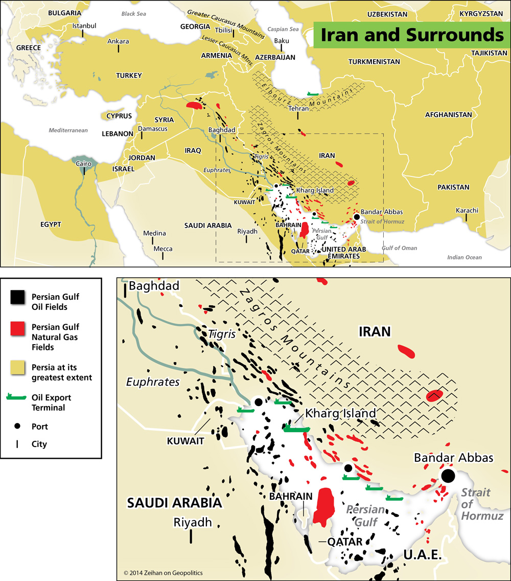
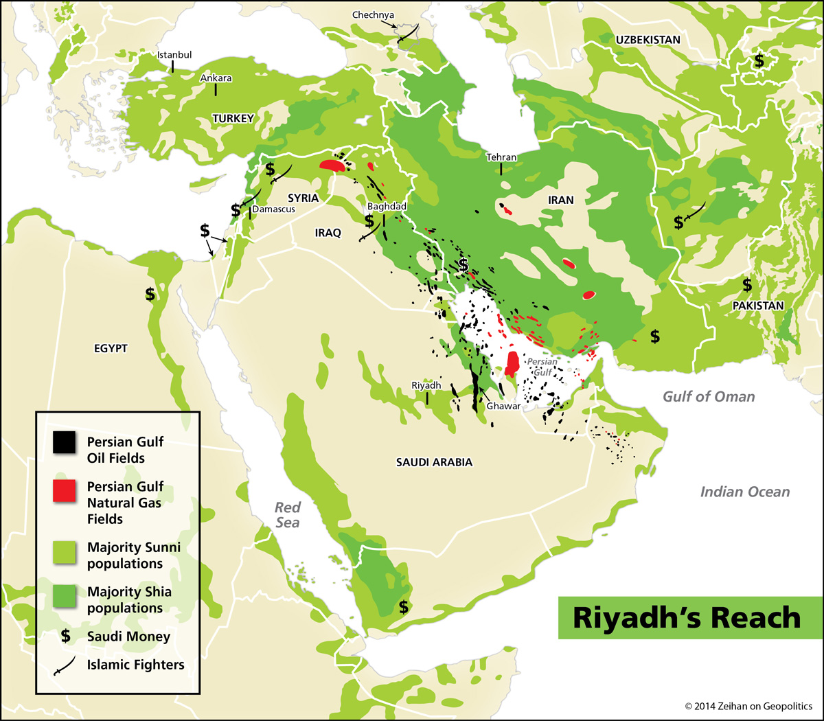
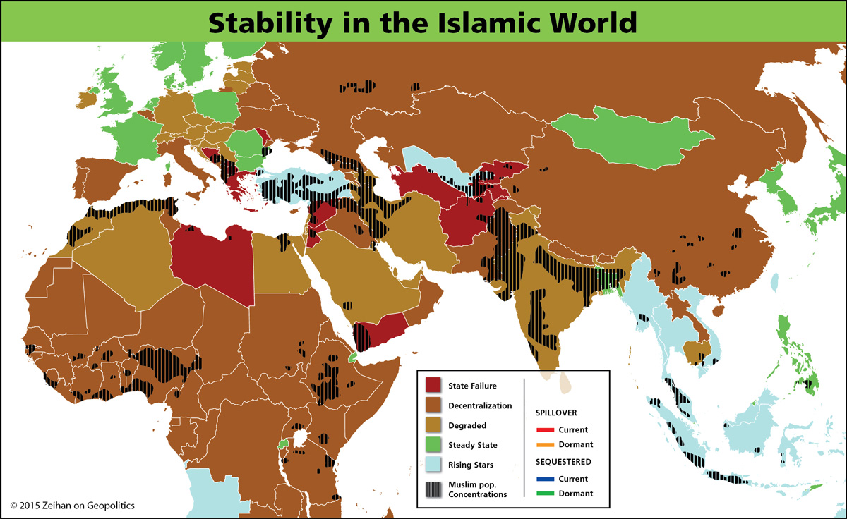
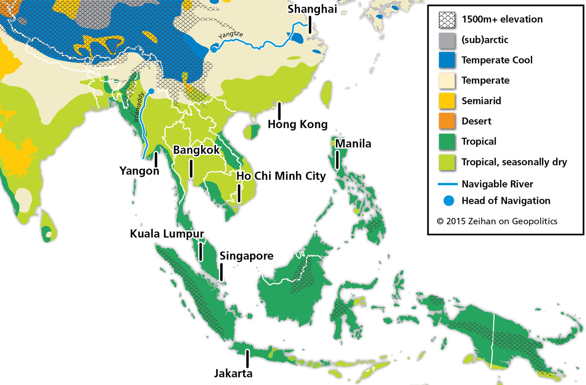
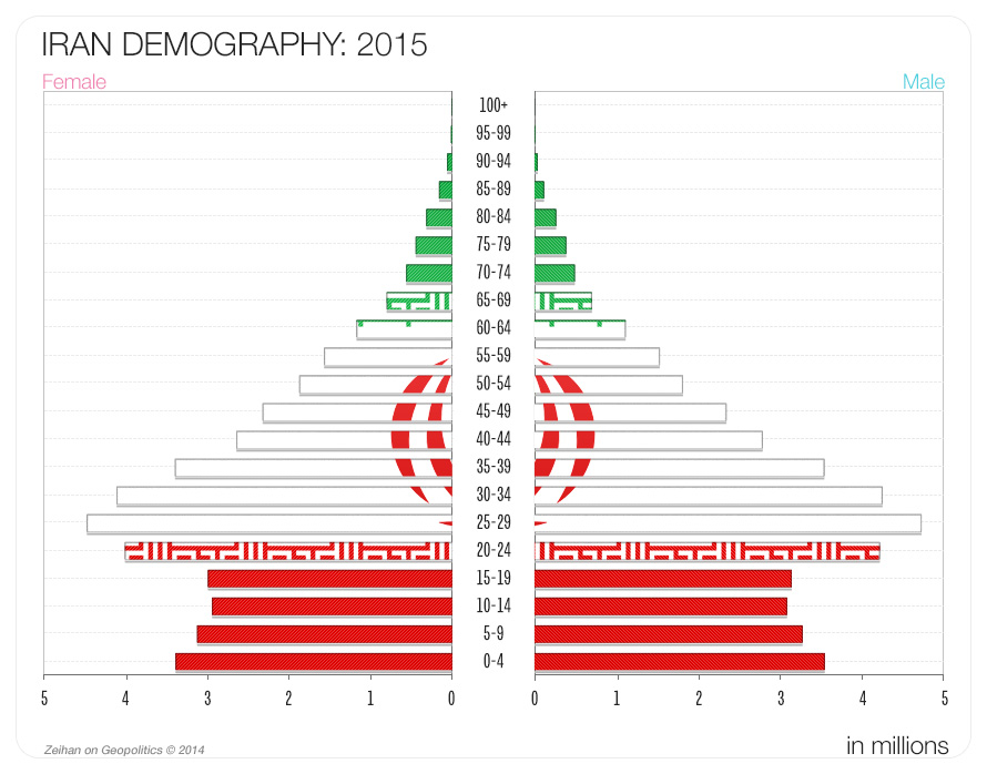
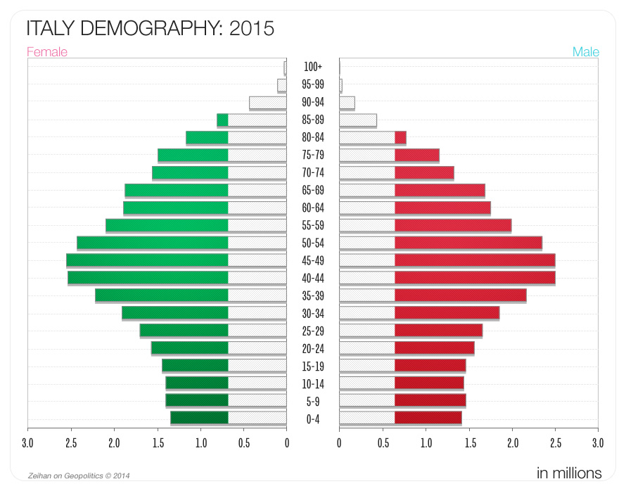
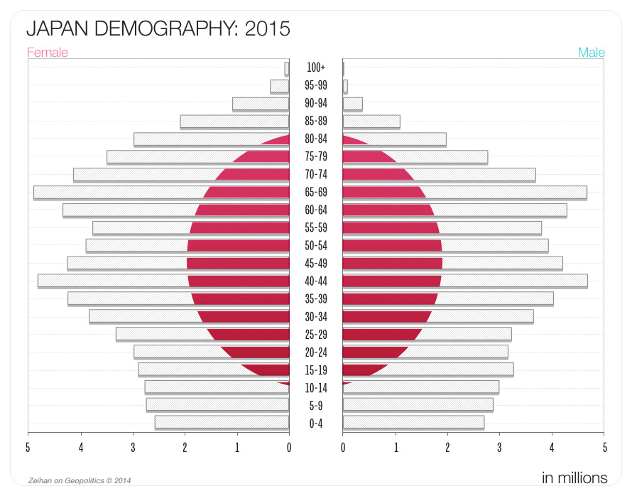
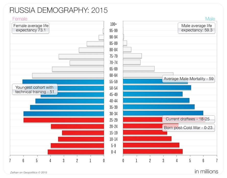
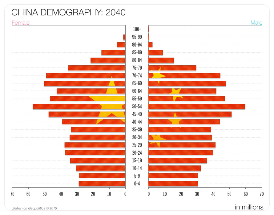
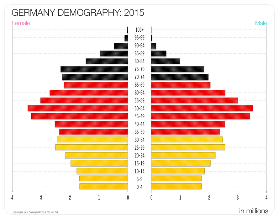
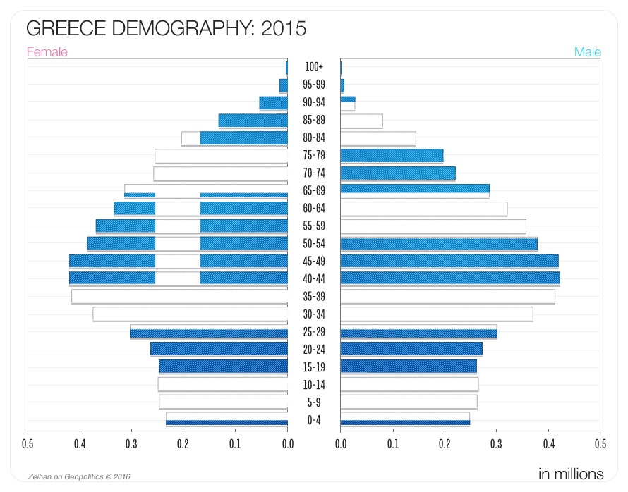
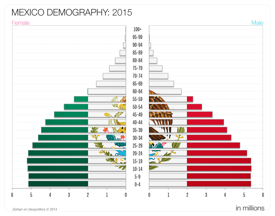
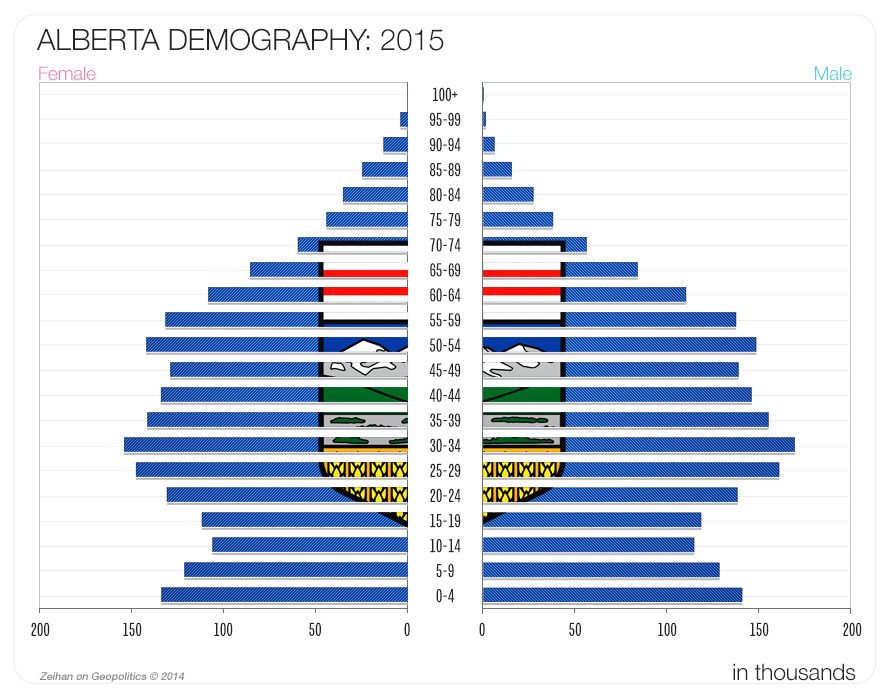
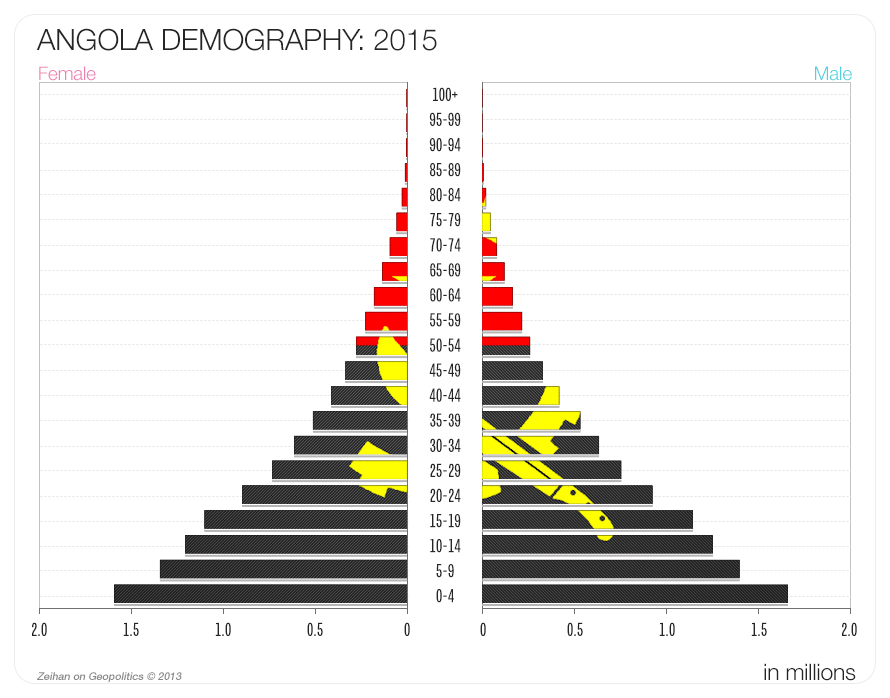
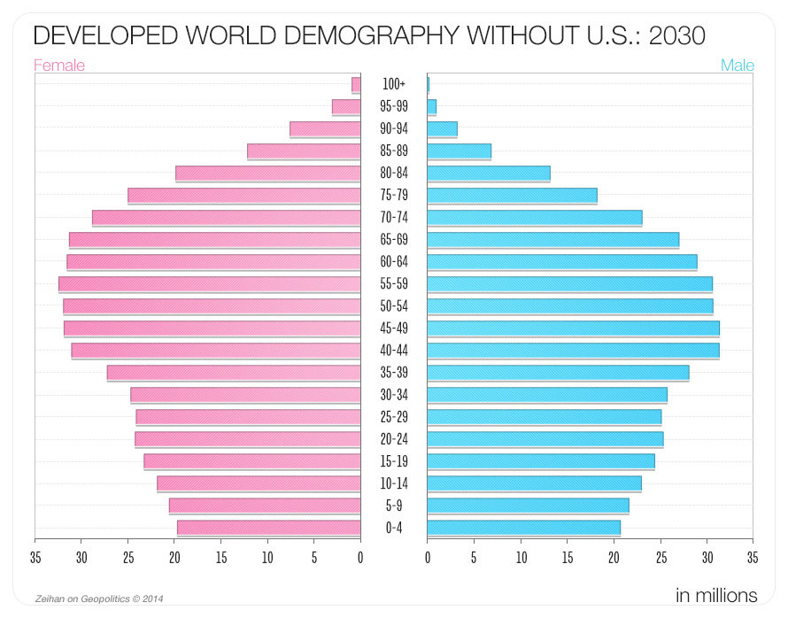
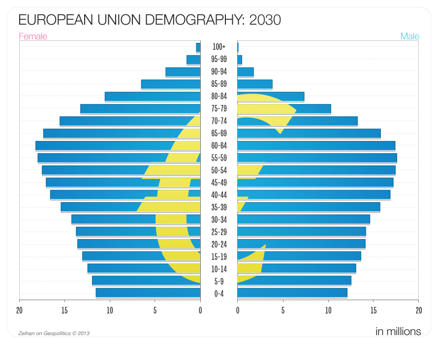
We’ve collected the graphics from The Accidental Superpower. Maps can be seen in color and in higher resolution, along with the demographic data and other visuals in TAS. Click an image to view in high resolution
Maps
US Canada Border
Chinese Climate Zones
China Hemmed In
Chinese Economic Concentrations
Germany’s Export Profile
Europe Political
Climate Threatened By Sea Level
SE Asia Cropped
Egypt and the Nile
South Asia Climate Zones
US Croplands
Egypt
China Hemmed in #2
Chinese Climate Zones
The Chechen Challenge
Europe Topographic
Thailand’s World
Russia’s Tatar
Canadian American Energy
Mexican Land Use
The World At Night
Global Stability Map
Russia’s Western Borderlands
Southeast Asian Trade Network
Iran and Surrounds
Riyadh’s Reach
Southern Africa
Stability in The Islamic World
SE Asia
The World at night
Uzbekistan and Surrounds
America’s Inner Circle
Eurasian Hordelands
Bretton Woods World
Japanese Needs
Pakistan
N American Climate Zones
Critical Nodes
Turkey’s Neighborhood
Global Land Quality
World At Night: Shale
Atlantic Sea Approaches
Ottoman Empire
Pacific Approaches
Global Map
Population data
India 2015
Iran 2015
Italy 2015
Japan 2015
Russia 2015
Saudi Arabia 2015
Combined Demography
Canada 2015
China 2015
China 2040
Developed Without the U.S.
Germany 2015
Greece 2015
Mexico 2015
Poland 2015
U.S. 2015
U.S. 2030
Uzbekistan 2015
China 1990
South Africa 2015
Spain 2015
Turkey 2015
Alberta 2015
Angola 2015
Developed World Without the U.S. 2030
EU 2030
Graphs
Russian Oil Production
Private Sources of Funding, 2011
U.S. Electricity Prices
N American GDP 2011
Chinese Lending
U.S. Oil Production
Start typing and press Enter to search
GEOPOLITICAL INSIGHT STRAIGHT TO YOUR INBOX
Get the latest in analysis, foreign policy, economics, and world events directly from Zeihan