Africa is a bit of a nightmare. Its coast is smooth with very few shielded bays that can serve as ports. Deserts, mountains, swamps, and jungles take turns walling off the ocean from nearly any portion of the continent that might be flat enough, temperate enough, or arable enough to support a city. Rogue currents and rocky outcrops even condemn a portion of southern Africa to be called the aptly named Skeleton Coast, since the wrecks of countless vessels litter its shallows.
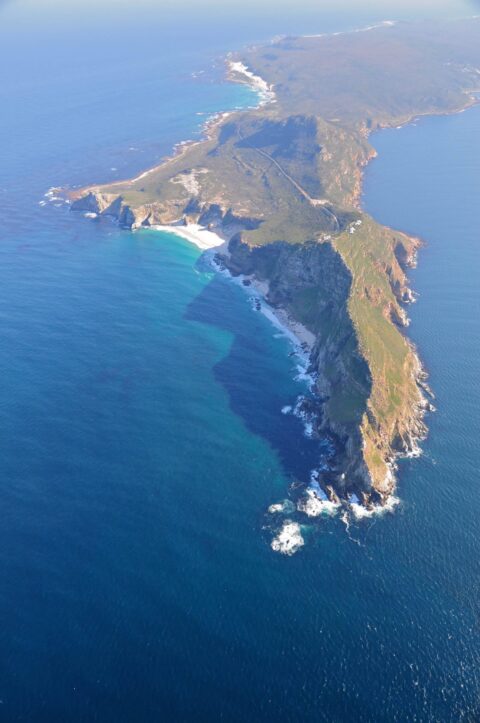
The Cape of Good Hope (above) at the continent’s southern tip signifies more than simply the mid-point in a horrible voyage between Western Europe and the Indian subcontinent. It is symbolic of the broader problem: how do you get halfway around the world when your mode of transport requires you staying within sight of a continent that is simply brutal to all who try to travel around it?
More than anything else, the difficulty of Africa allowed the Indian Ocean basin to wallow in splendid isolation for centuries. Blessed with winds, currents, and shorelines that are as predictable and secure as Africa’s were brutal and wily, the natives of the Indian Ocean basin engaged in measured, predictable regional trade centuries before the rest of the world.
In time, the Portuguese and Spanish unlocked the technologies of deepwater navigation, drastically altering the economic and political map of the world. First, Africa could now be bypassed; ships that didn’t have to sail near the coast could simply ignore Africa completely. Second, ships that could ignore Africa could enter and ply the Indian Ocean at ease, transforming it from a secluded land of riches to an easily-exploited, economically-oppressed, and geopolitically irrelevant backwater – a status it largely has continued to wallow in.
For more on how deepwater navigation shattered and remade the world, see Chapter 3 of The Accidental Superpower.